Maps Page on
Norway, Sweden and Denmark
Outline
- Physical Environment
- Norway Elevations
- Scandinavian Topography
- Denmark Elevation
- Weather & Climate
- Norway Koppen Climate Map
- Sweden Koppen Climate Map
- Denmark Koppen Climate Map
- Human Environment
- Scandinavian Population
Density
- Scandinavian
Urban/Rural typology
- Scandinavian Land Usage
- Road maps
- Road Map of Norway
- Sweden Road Map
- Road Map of Denmark
- City Maps
- Oslo, Norway Map
- Stockholm, Sweden Map
- Copenhagen, Denmark Map
- Urban Transportation Maps
- Oslo Rail Systems
- Stockholm Lines Map
- Copenhagen Rail Lines
Map
- Tourist Maps
- Norway Tourist Sites
- Oslo Tourist
Destinations
- Stockholm Tourist Sites
- Map from Travel Book
- Norway National Parks
Map from Travel Book
1 Physical
Environment
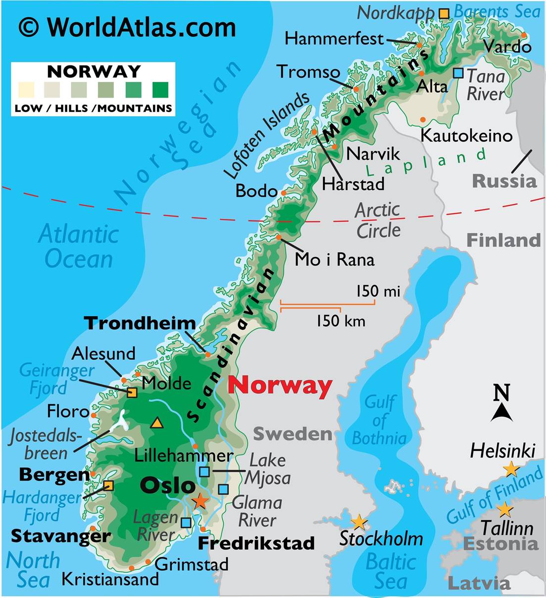
The different elevations of Norway split into low, hills and mountains.
https://www.worldatlas.com/upload/fc/43/fe/no-01.jpg

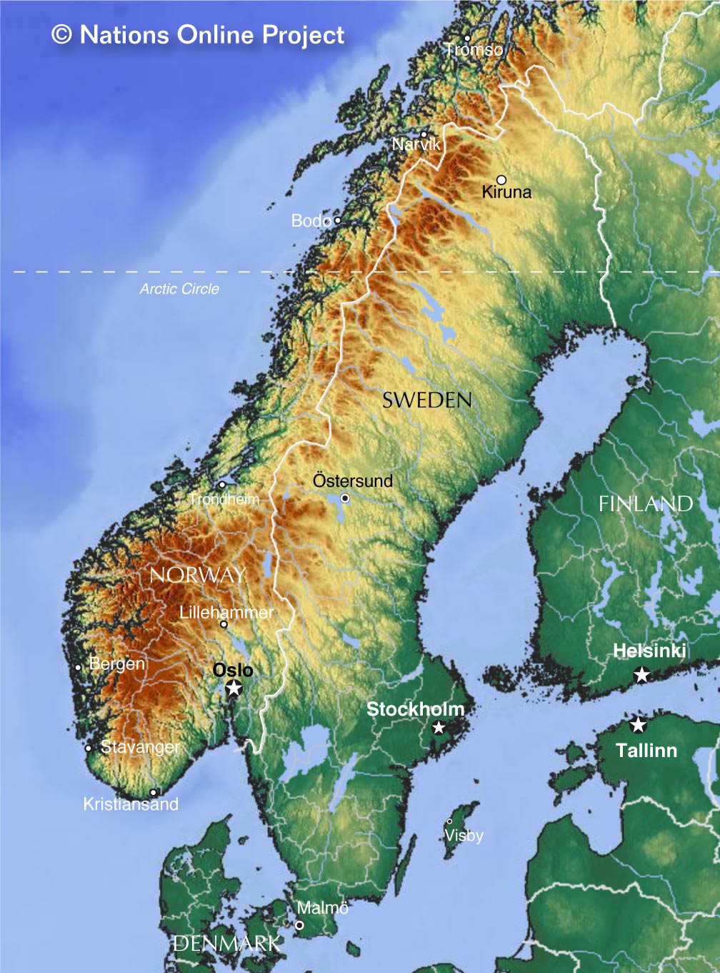
A depiction of the topography of the Scandinavian countries including Norway, Sweden and Denmark.
https://www.nationsonline.org/maps/Sweden-Scandinavia-topo-map.jpg

The elevations shown in meters above sea level of Denmark.
https://meteomaffezzoni.files.wordpress.com/2016/08/denmark-map.jpeg
2 Weather &
Climate
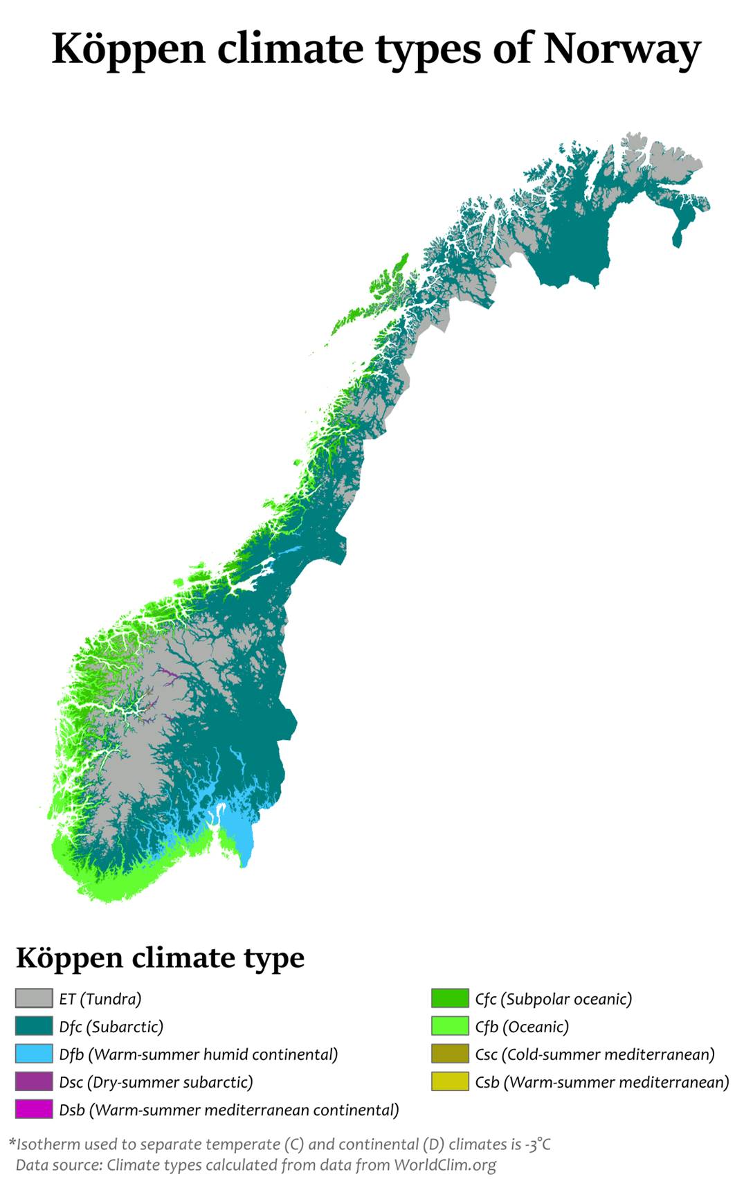
A koppen climate map showing the different climate regions in Norway.
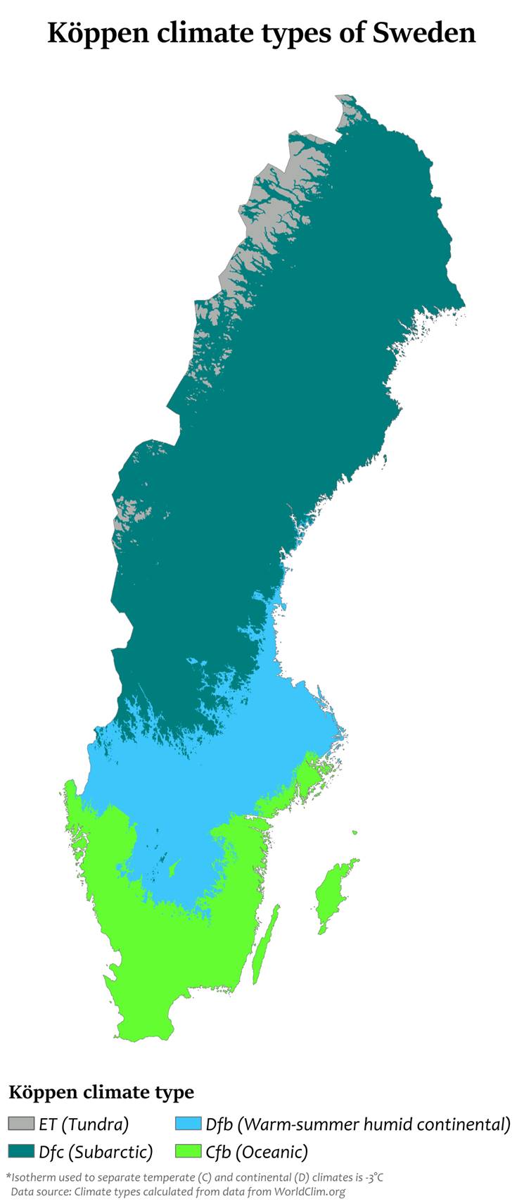
A koppen scale of the different climate regions in Sweden.
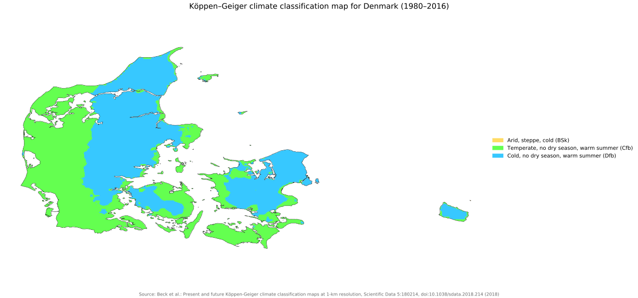
A climate map showing the different climate regions of Denmark.
3 Human Environment
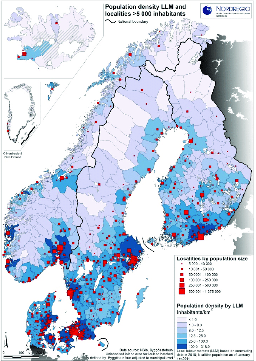
The population density of the countries of Scandinavia including Norway, Sweden and Denmark among others.
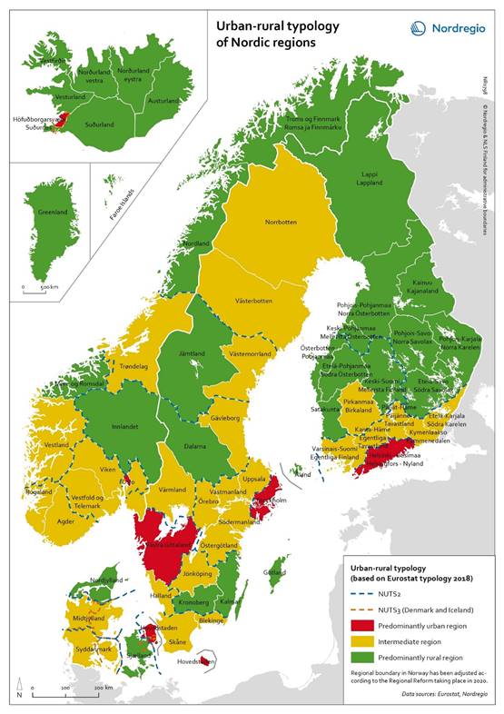
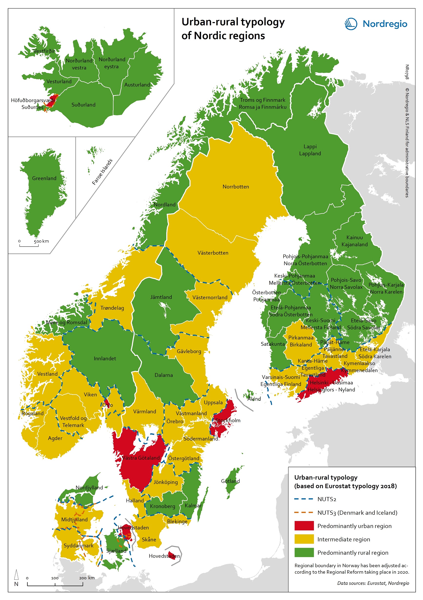
The divide between Urban and Rural areas in the countries of Scandinavia.
https://nordregio.org/wp-content/uploads/2020/02/0798_Urban_rural_typology_of_Nordic_regions_web.jpg

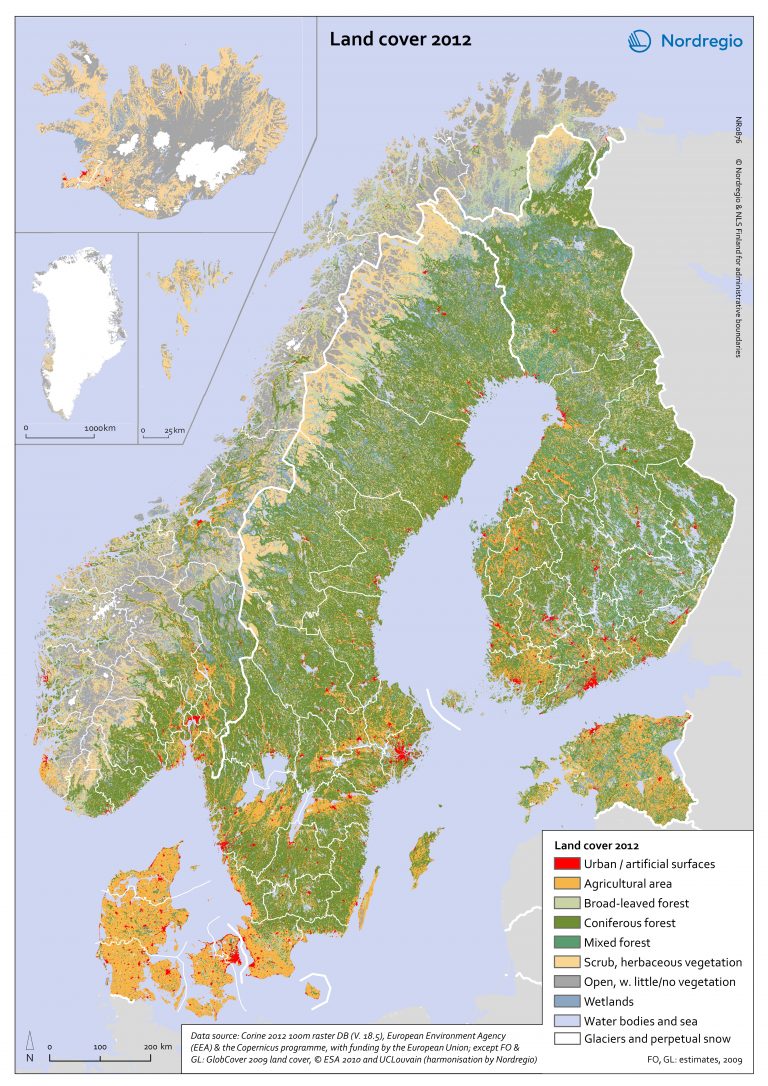
The different uses of land in the countries of Scandinavia.
https://nordregio.org/wp-content/uploads/2018/11/Land_cover__2012-768x1086.jpg
4 Road Maps
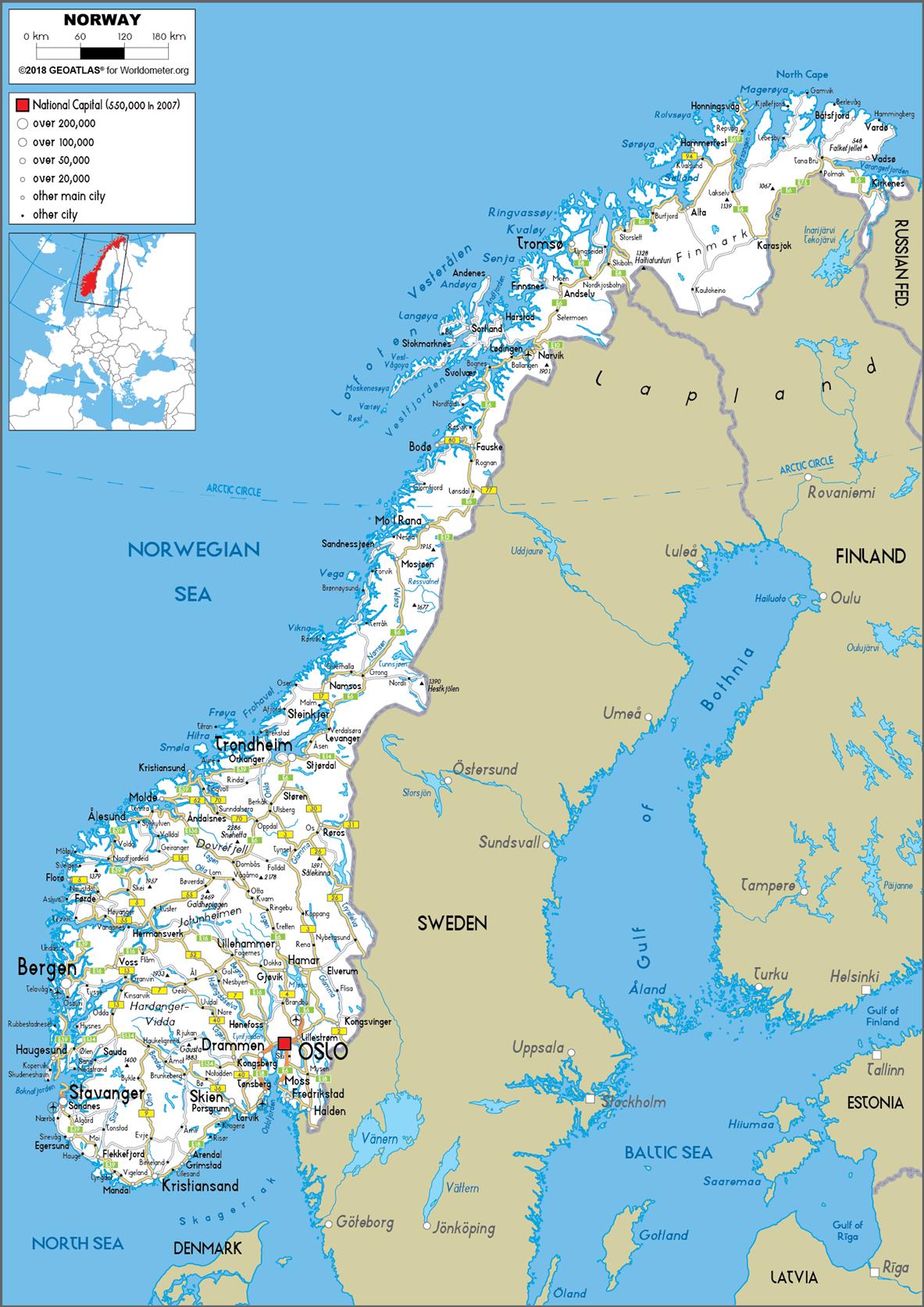
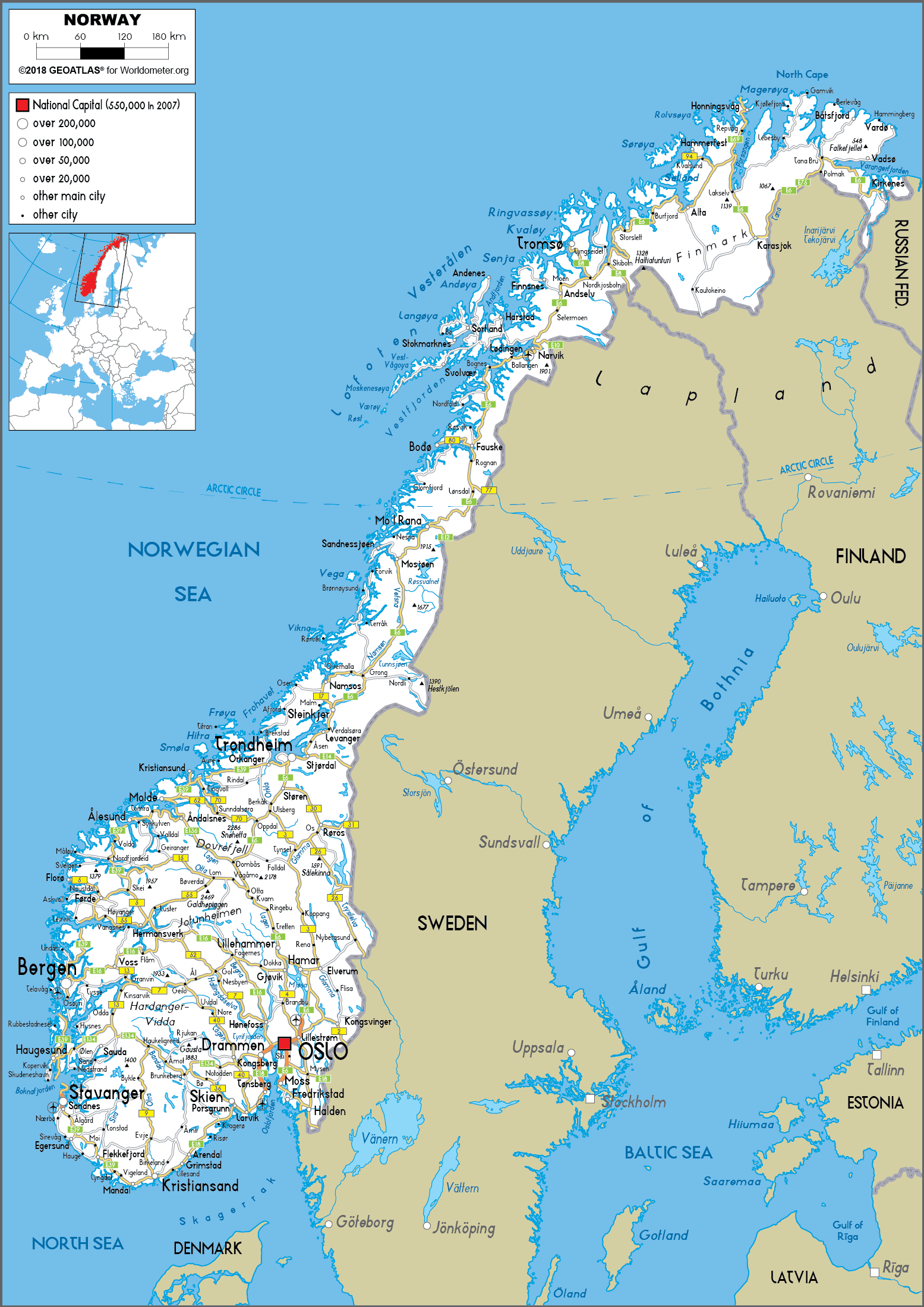
The roads throughout Norway.
https://www.worldometers.info/img/maps/norway_road_map.gif
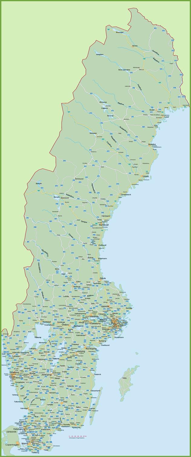
The roads around Sweden.
https://ontheworldmap.com/sweden/sweden-road-map.jpg
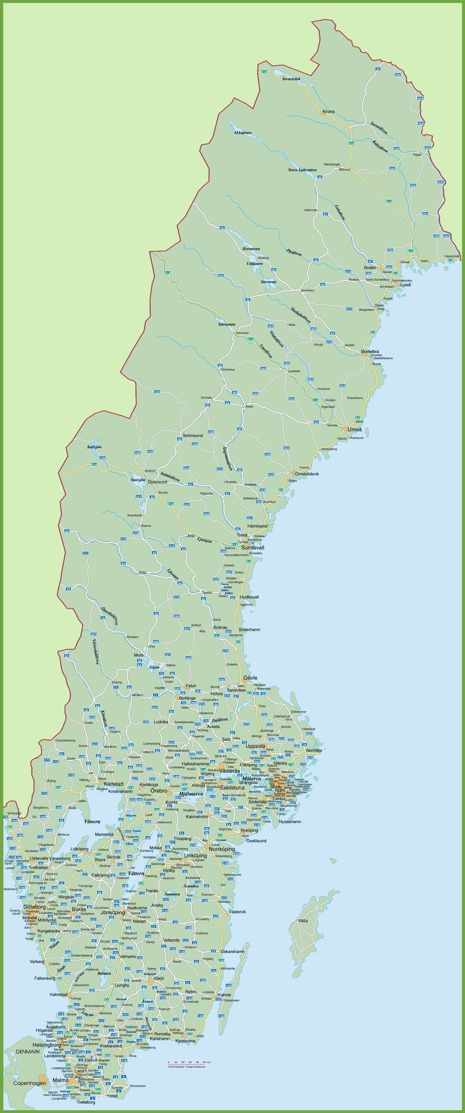
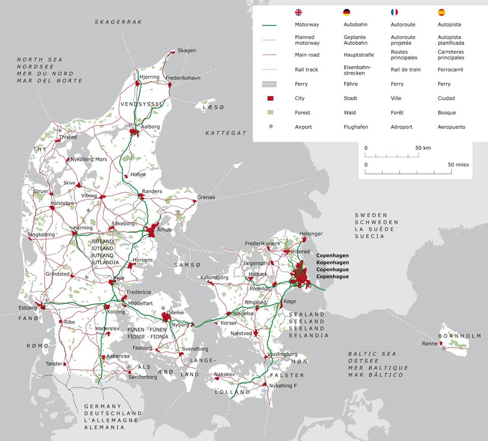
Existing and planned roads throughout Denmark.
https://ontheworldmap.com/denmark/denmark-road-map.jpg
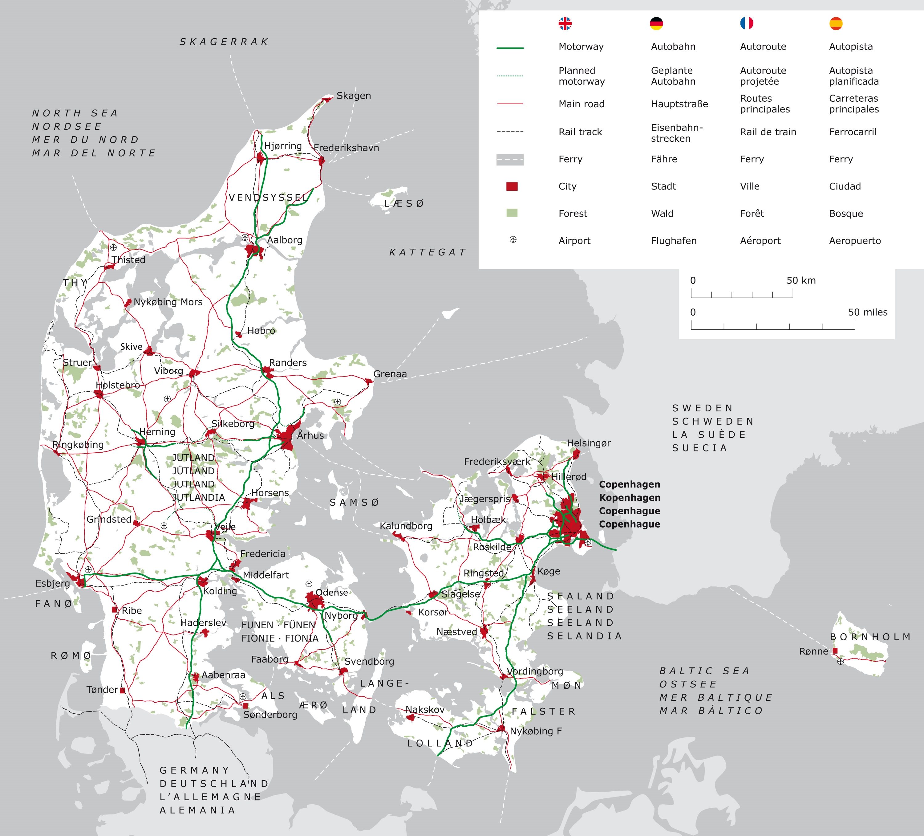
5 City Maps

Google Map image of Norway’s largest city Oslo.
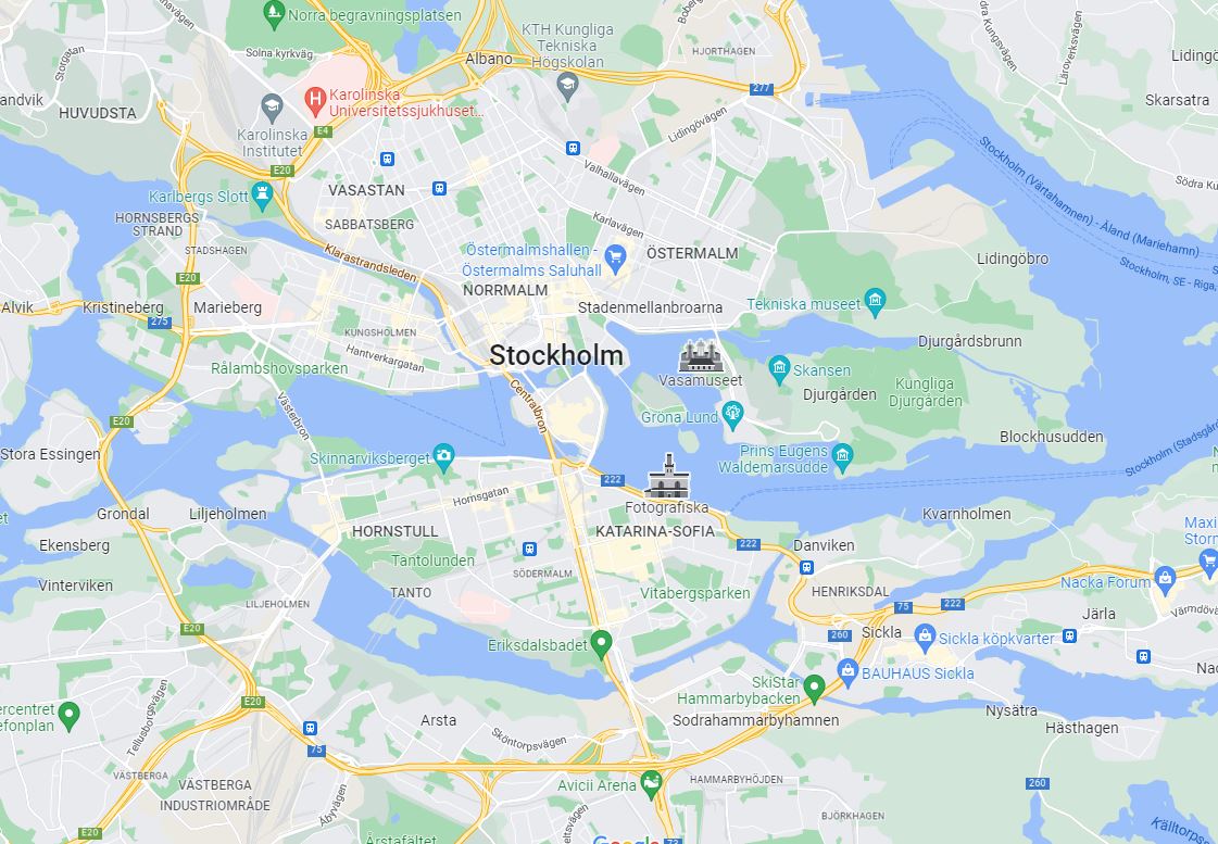
Google maps image of Stockholm, the largest city in Sweden
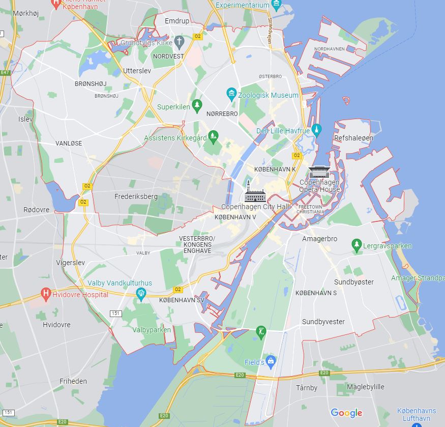
Google map image of Copenhagen, Denmark.
6 Urban
Transportation
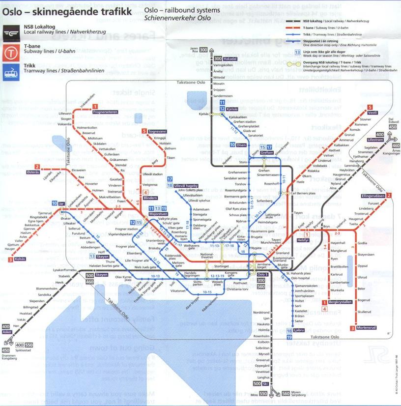
A depiction of the local rail line, subway line and tram line in Oslo, Norway
https://i.pinimg.com/originals/73/0e/04/730e04b582b8d495983424063d4105e1.jpg
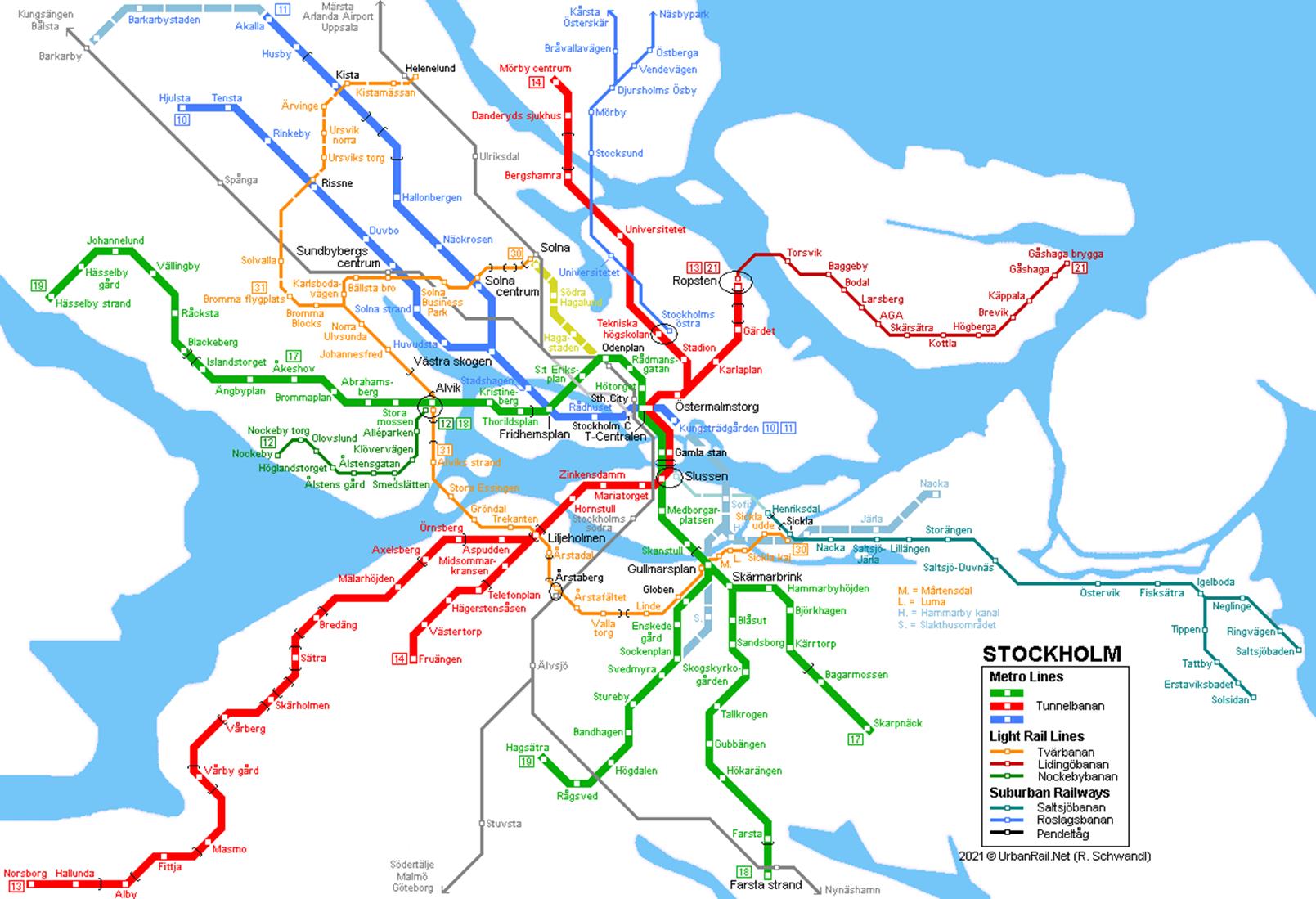
Metro, light rail and suburban railway line in the city of Stockholm, Sweden.
https://www.urbanrail.net/eu/se/stockholm/stockholm-tunnelbana-map.png
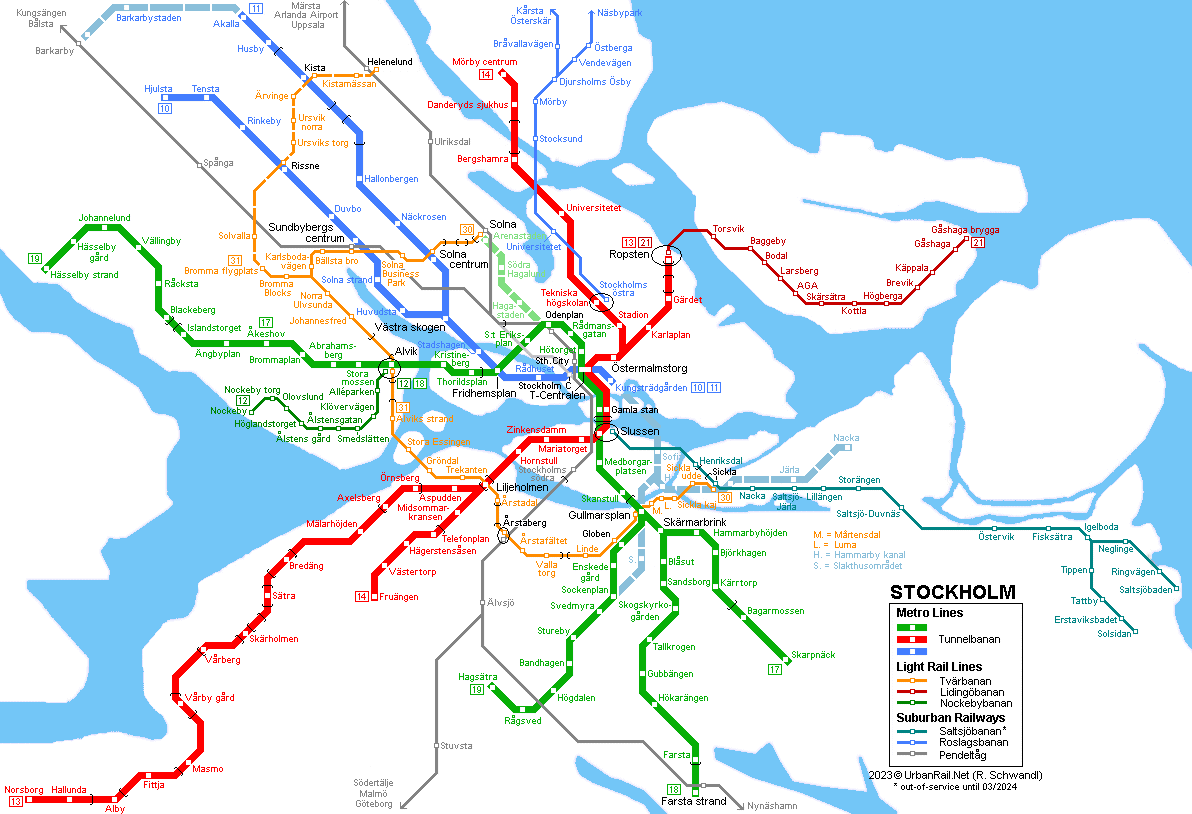
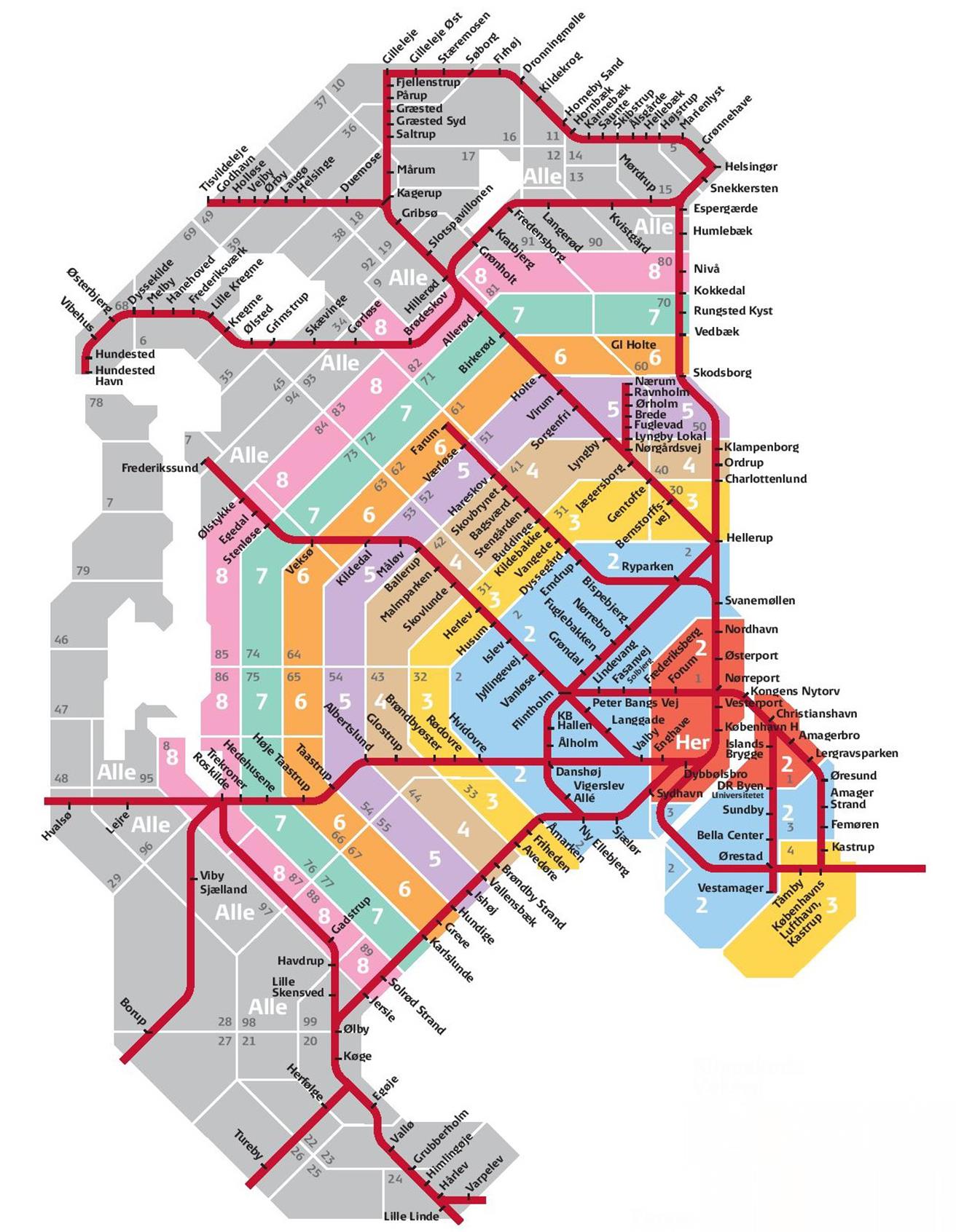
The rail lines in the city of Copenhagen, Denmark.
https://www.scandinaviastandard.com/wp-content/uploads/2018/02/Copenhagen-Zone-Map.jpg
7 Tourist Sites
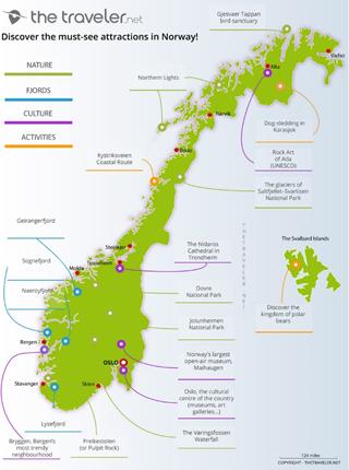
The tourist sites located across Norway.
https://www.thetraveler.net/images/map/norway/map-norway-where-to-go-1000.jpg
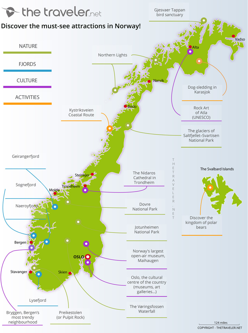

Oslo, Norway’s tourist destinations.
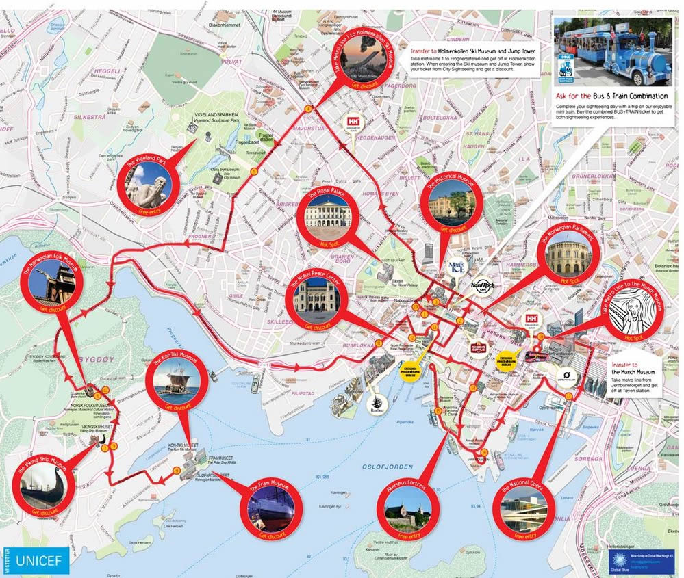

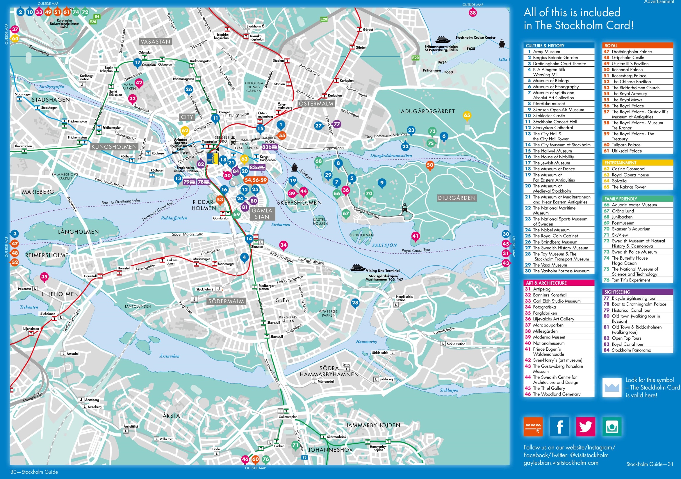
The tourist sites in Stockholm, Sweden.
https://ontheworldmap.com/sweden/city/stockholm/stockholm-tourist-attractions-map.jpg
8 Map from Travel
Book
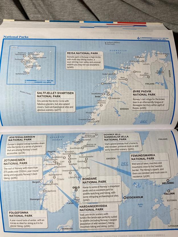
The National parks in Norway from Lonely Planet’s Norway travel book. I will also be getting the Scandinavia Lonely Planet travel book.
Submitted
by Jacob Holmes on March 11, 2022.